
Hiking in Westcliffe, CO
Share This Page
Your Guidebook
The ideal home base for your hiking adventures
You’d be hard pressed to find a better spot than Westcliffe if you enjoy hiking and camping. With the Sangre de Cristo and Wet Mountain ranges in your backyard, there’s a seemingly endless array of trails to explore. Whether you want to tackle a 14’er—or take a more laidback walk through the woods—there’s options to meet your appetite for adventure.
And best yet, the trails around Custer County are essentially never crowded. Unlike some trails in more populous and tourist-heavy areas of Colorado, you can truly escape in nature here.
At this elevation, hiking is breathtaking (in more ways than one.) A word to the wise: If you’re coming from a low elevation town, you may want to give yourself a day or two to adjust before getting too adventurous.
Get a quick lay of the land below with an overview of some of the most loved trails around the Wet Mountain Valley. For more info, check out Trails for All, Custer County’s grassroots group that maps and maintains local trails. All Trails is also a great resource to look up popular local hiking spots.
The 14'ers: Humboldt, Crestone & Crestone Needle
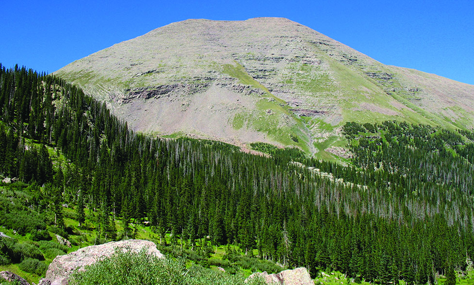
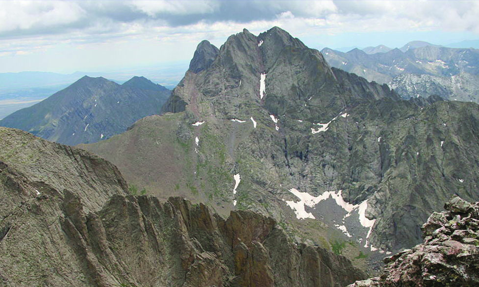
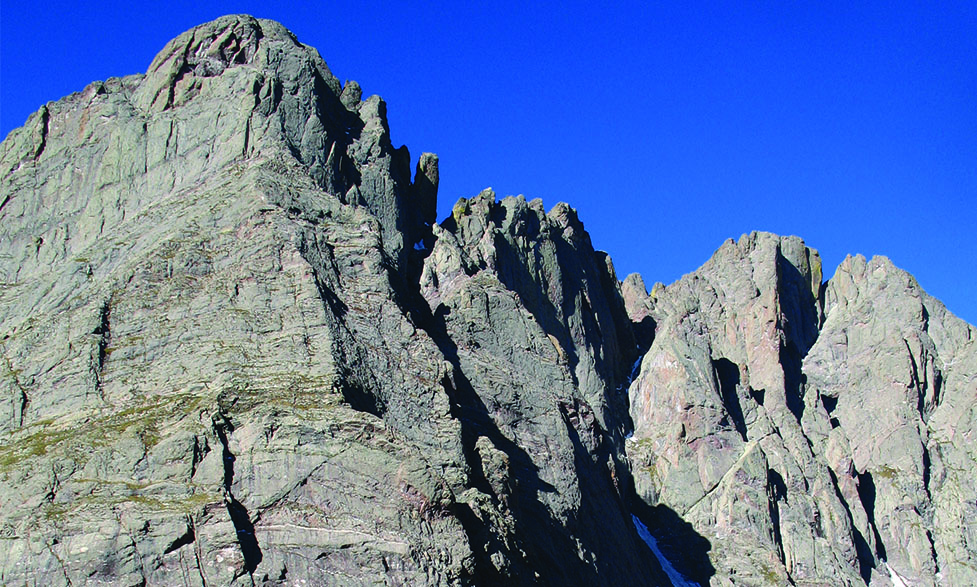
Some of Colorado’s tallest peaks, nicknamed ’14’ers’ because they surpass 14,000 ft. above sea level, are easily accessible from Westcliffe. The three closest peaks–Humboldt Peak, Crestone Peak, and Crestone Needle–are all accessible from South Colony Lakes basin. The trailhead is just 10 miles south of town by Highway 69. Often, hikers making the summit will set up a base camp here to get a start on the journey to the top.
Humboldt Peak is the easiest of the three by a stretch, but it’s still classified as a Class 2 Trail. Crestone Peak and Crestone Needle are reserved for the most experienced of hikers with Class 3 or Class 4 trails, depending upon the route.
While the journey isn’t easy, the views from the top are extraordinary.
Popular trails
Comanche-Venable-Alvarado Loop
The Comanche-Venable-Alvarado Loop features easy to moderate trails running through the San Isabel National Forest, starting from the Alvarado Campground which is quickly accessible from Westcliffe. Choose from three separate loops, ranging from 1.7 to 2.4 miles.
The full Venable-Comanche loop, two trails that combine for a 12-mile trek, is great for those seeking a full-day adventure.
Rainbow Trail
There are many easy access points to the famous Rainbow Trail from Westcliffe. The entire trail spans over 100 miles along the base of the Sangre de Cristo Mountains. Much of the Rainbow Trail is easy to moderate, but many more difficult trails offshoot from the Rainbow, heading vertically up to the mountain to various lakes and peaks. This is sure to be on your favorites!
Lakes of the Clouds
The Lakes of the Clouds is an incredible destination for hikers or fisherman alike. Starting from the Gibson Creek Trailhead, you can hike out & back or make a slightly longer loop. Stop at the lakes and fish, or keep going to explore Spread Eagle Peak. Either way, hiking this trail makes for a guaranteed great day.
Explore more
Trails for All
Custer County’s grassroots movement to steward the trails of the Wet Mountain Valley for all users. Visit their website for detailed local trail summaries and maps.
All Trails
Check out user reviews, photos, and trail descriptions for many of the most popular hikes around Custer County.